Winter has come. The days have grown short and the nights long.
High above the lands, the atmosphere is almost serene. The wars and daily conflict seem far away; but even here the busy activity and effects of players can be clearly seen!
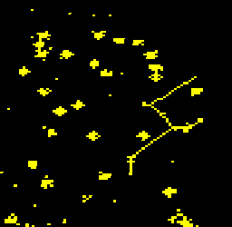
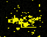
At night the lights of the settlements and sovereignty glow bright:

Flying into central Elgea you can see the ring of settlements formed by new players:

Looking to the south-west, the outline of the ocean is visible as well as the smaller settled islands. Also some almost constellation-like joined up lights can be picked out:

Turning up the contrast and zooming in shows some interesting player land claims. All over the map an Alliance is claiming road like structures:

While another owns land in a shape that resembles a person with a hat and a cape?

Reviewing the bill of land ownership lodged at King Sigurd’s Council Of Illyria; indeed this land is claimed by the alliances: Fairy Road Authority and Silly Hats respectively. Creative expansion plans!
Academic Aside: An interesting analysis, when just considering player towns (excluding sovereignty), their arrangement resembles a Poisson disk sample. 99% of these towns outside the “new player ring” are consciously placed by thousands of individual players acting independently.

You devs must be happy you don’t have to program that Poisson thing, but have thousands of players doing it on their own (thanks to 10 square rule of exodus)
=)
Is there a way for non-devs for looking up those sov structures? (Or will there be one?)